Name: Perdeberg
From Kimberley, Perdeberg and Petrusburg to Bloemfontein
Google count:Date:Historic fact:Other interesting info:Where to stay:
Tuesday, August 31, 2010
Pepworth (J 12)
Name: Pepworth
Source: http://samilitaryhistory.org/vol061ob.html
They either loved fighting, hated the British, or had high hopes of future rewards from their employers (and frequently all these motives were present at once). In common with the other foreign corps serving with the Boers, the Irish Brigade adopted Boer tactics. Generally speaking, they were courageous but inferior to the Boers in skill, and more than on one occasion, (e.g., at Elandslaagte and Magersfontein) allowed themselves to be surrounded, captured or destroyed. Relations between the Irish Brigade and the Boers were often strained (as were relations between other foreign volunteers and the Boers). The former invariably expected more than they were either accorded or received(7). Blake's section distinguished itself at Pepworth, near Ladysmith, where it stood its ground under a hail of British shrapnel, dragging a great deal of ammunition up the hill. This unit was later engaged in the operations at Brandfort and in the surrounding regions. The Section under Col Lynch was also involved in the fighting around Ladysmith and was particularly acclaimed following its stand near Dundee in the general Boer withdrawal. Indeed, it was said to be the one Foreign Corps in the general confusion of the time that achieved some distinction. By resisting the British advance for over an hour it gained valuable time for the remainder of the force engaged. Towards the end of the War Lynch's section was in action in the Barberton and neighbouring regions.
Google count:Date:Historic fact:Other interesting info:Where to stay:
Monday, August 30, 2010
Pemba (F 4)
Name: Pemba Zambia
Pemba is a small town (population about 4,000) (Another small town, scarcely more than a dot on the map, Pemba is about 261km from Livingstone http://www.zambia-travel-guide.com/bradt_guide.asp?bradt=488) located in Choma District of the Southern Province of Zambia. It is situated on the 'Great North Road' that runs between Lusaka and Livingstone. The main ethnic group in the town are the Tonga. Prominent educational institutions found here are Pemba Basic School, Pemba High School and Kasia Secretarial College.
Pemba also hosts the Zambian National Broadcasting Corperation (ZNBC) television transmitter station for the Southern Province.
13°36'0"S 32°27'0"E
Google count:Date:Historic fact:Other interesting info:Where to stay:
Saturday, August 28, 2010
Peelton (H 15)
Name: Peelton
Source: http://www.sahistory.org.za/pages/places/villages/easternCape/peelton.htm
Umxelo was established in 1839 by the Reverend Richard Birt as a station of the London Missionary Society. At that stage it was popularly referred to as Birt's Mission, and was located a short distance from the village of Chief Bhotomani, near Fort Beaufort. The station was destroyed in 1846 during the course of the frontier war of 1846-48, better known as the War of the Axe.
When hostilities drew to an end in 1848, the missionaries moved to a new site closer to King William′s Town where they established the Peelton mission station. This they named in honour of the British Prime Minister, Sir Robert Peel. The new station was destroyed during the frontier war of 1850-53, and was rebuilt in 1853. The 1875 census indicated that Peelton had a population of 1,512. By 1904 this number had risen to 2,487, of whom 576 were literate.
The Reverend Birt's first wife came out from England with him in July 1838, and died in an accident thereafter. Birt then married Mrs Scott, the daughter of Robert Hart of Glen Avon who was also a wealthy widow in her own right.
Prepared by Franco Frescura.
Google count:Date:Historic fact:Other interesting info:Where to stay:
Paulpietersburg (J 10)
Name: Paulpietersburg
Source: http://www.kzn.org.za/index.php?cityhome+2027
Paulpietersburg is a small, pretty town nestling in the foothills of the Dumbe Mountain - a big, flat-topped, triangular mountain in the middle of flatlands territory, popular with paragliders and hikers and named after the wild dumbe fruit which grows on its slopes.The roots of Paulpieteraburg lie in a piece of the then Transvaal Boer republic surveyed by HJ Maarschalk in 1888. The demarcated land was named in honour of Boer president Paul Kruger and Voortrekker hero Pieter Joubert.
Paulpietersburg played its part in the military shaping of the region. General Louis Botha met his troops at the nearby Egode River before departing to Vereeniging to sign the peace treaty that ended the Anglo-Boer War. The peace treaty that ended the Anglo-Boer war was thus NOT signed at the nearby Egode River as often said, while the Anglo-Zulu war site of Ntombe is 30km away.
Paulpietersburg is also on the Rainbow Route, an alternative means of reaching the coast that starts in Mpumalanga and passes through Paulpietersburg, Vryheid, Melmoth, and Piet Retief and ends in the town of Mtunzini. Paulpietersburg is only 3.5 hours' drive from Johannesburg and Durban and popular with visitors because of the nine hot and cold mineral water pools at the Natal Spa just 9 km outside of town. The spa is fed by a natural, hot spring that surfaces on the southern approaches to the 1 536m Dumbe Mountain.
Google count:Date:Historic fact:Other interesting info:Where to stay:
Paterson (F 15)
Name: Paterson
Paterson is a little town in the heart of game reserve country, ideal for travellers wanting to visit Shamwari Game Reserve or the Addo National Elephant Park. A number of private game reserves specialize in day and night game drives to experience the sheer beauty of this part of the world.
Google count:Date:Historic fact:Other interesting info:
Where to stay: http://www.wheretostay.co.za/ec/cs/accommodation/paterson.php
Wednesday, August 25, 2010
Patensie (F 16)
Name: Patensie
Google count:Date:Historic fact:Other interesting info:Where to stay:
Google count:Date:Historic fact:Other interesting info:Where to stay:
Parys (F 10)
Name: Parys
In the early 1870's, towns in the northern Free State were set very far appart and members of the different churches had far to travel to participate in their religious services. It was then decided by the Ring of the Dutch Reformed Church to implant the idea of a congregation, north of the Rhenoster River, into the minds of residents of the farm Klipspruit. The farm, situated on the Vaal River was then owned by three van Coller brothers Phillip, Hans and Dolf van Coller, mrs. W.J.I. Davel anb her son, Willem Davel. Two of the Van Coller brothers lived in what is today known as Oranje street, and the third brother in Boom street, Willem Davel lived in present Water street. Three gentlemen, Messrs. de Villers, Luyt and Fleck were sent to the owners of Klipspruit to induce them to lay the farm out as a township, but the van Coller brothers were very reluctant to listen to the arguments put forward by the three men. Not giving up hope of laying out a township, the three gentlemen went to the adjoining farm, Vischgat (the present Vredefort). The owners of Vischgat were more amenable to argument and inducement, and it was not long before the township of Vredefort was born.
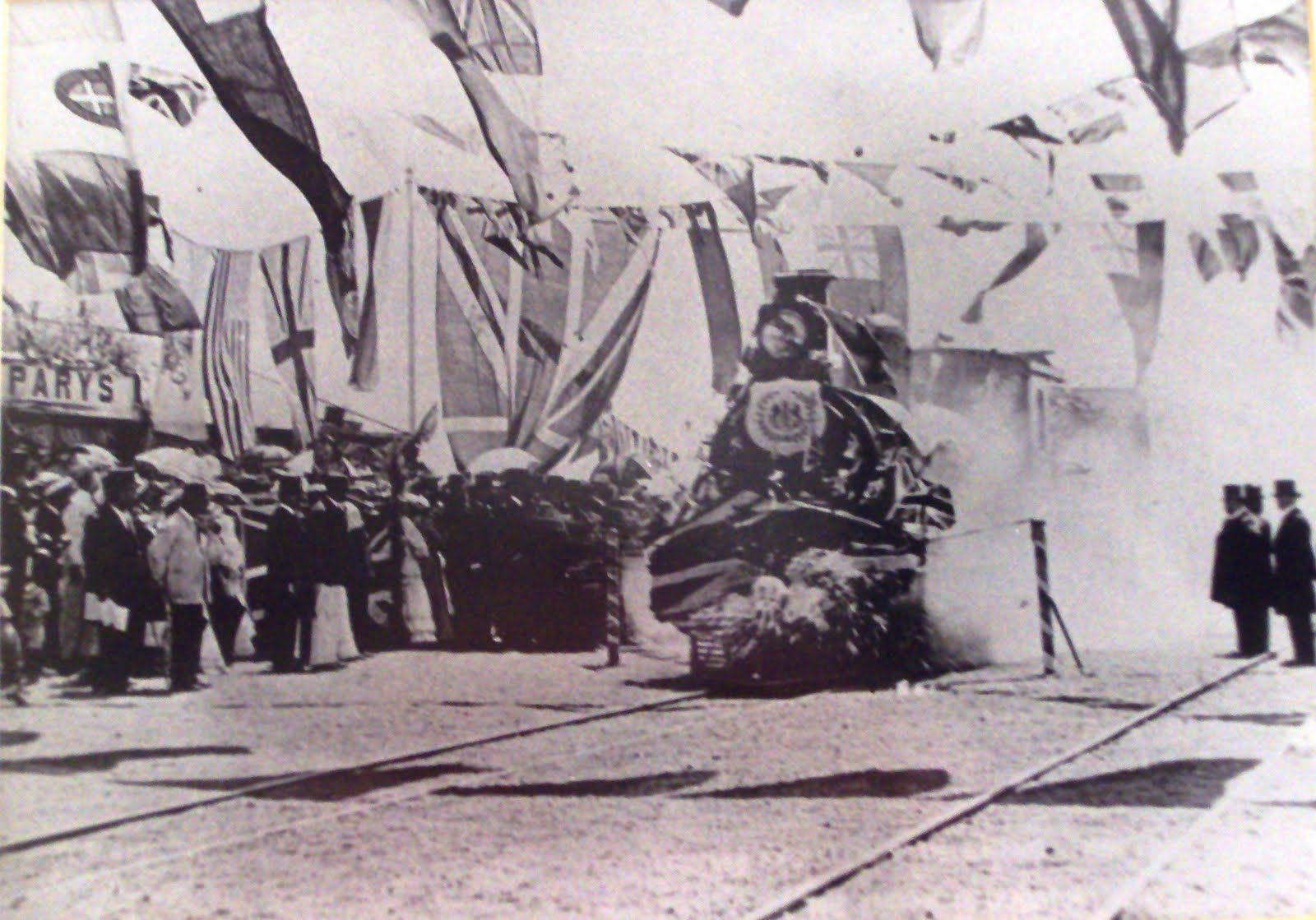
The owners of Klipspruit soon awoke to the fact that a golden opportunity had slipped through their fingers, and set out in haste to restore matters. History does not record the steps they took, but it seems probable that they secured the sympathy of the Dutch Reformed Church. Later on in 1876 when the town was laid out, a goodly portion of ground was set aside and donated to the church. (The church building is shown above in 1891 during the Anglo Boer war being used by the British as they thought that the Boers will not attack a church). On the 14th of June 1876 the first sale of seven erven was held by a Mr. Wouter de Villiers, at a price of £ 25 each.
More info on:
www.parysmuseum.co.za
Iris Andrew (Curator)
irisandrew@iafrica.com
Park Rynie (L 15)
Name: Park Rynie
Google count:Date:Historic fact:Other interesting info:Where to stay:
Google count:Date:Historic fact:Other interesting info:Where to stay:
Paarl (C 16)
Name: Paarl
Source: Wikipedia
Paarl (derived from Parel, meaning Pearl in Dutch) is a town with 191,013 inhabitants in the Western Cape province of South Africa. Its the third oldest European settlement in the Republic of South Africa (after Cape Town and Stellenbosch) and the largest town in the Cape Winelands. It is situated about 60 kilometres (37 mi) northeast of Cape Town in the Western Cape Province and is renowned for its illustrious past and haunting scenic beauty.
Today Paarl is part of the greater/metro part of the city of Cape Town.Paarl is unusual in South Africa in that the name of the place is pronounced differently in English and Afrikaans: in English it is pronounced /ˈpɑrl/ (rhymes with marl) but in Afrikaans it is Pêrel [pɛːrəl], although still spelt ‹Paarl›. An unusual feature of the name of the town is that Afrikaners customarily attach the definite article to it: people say in die Paarl ("in the Paarl"), rather than in Pearl.
Paarl also hosted a match from the ICC Cricket World Cup 2003.
The district is particularly well known for its Pearl Mountain or "Paarl Rock". This huge granite rock is formed by three rounded outcrops that make up Paarl Mountain and has been compared in majesty to Uluru (formerly known as Ayers Rock) in Australia. (However, they are not geologically similar. Paarl Rock consists of intrusive igneous rock, while Uluru is a sedimentary remnant).
Contents [hide]
1 History
2 Tourist attractions
3 Districts
4 Schools
5 Famous persons
6 External links
7 References
[edit] History
In 1657, while Abraham Gabemma was searching for additional meat resources for the new Dutch settlement at the Cape of Good Hope, he saw a giant granite rock glistening in the sun after a rainstorm and named it "de Diamondt en de Peerlberg” (Diamond and Pearl Mountain).[2] Gabemma (often also spelled Gabbema) was the Fiscal (public treasurer) at the settlement on the shores of Table Bay. The "diamonds" soon disappeared from the name and it became known simply at Pearl Rock or Pearl Mountain.
Then, in 1687, just 35 years after the arrival of Jan van Riebeeck at the Cape, land for farms was given to some Dutch and French Hugenot settlers on the banks of the Berg River nearby. The fertile soil and the Mediterranean-like climate of this region provided perfect conditions for farming. The settlers planted orchards, vegetable gardens and above all, vineyards,[3] which today produce some of the best red wines in the world.
[edit] Tourist attractions
Paarl RockLike many towns in the Cape Winelands, Paarl is home to a prosperous community, with many well maintained and attractive Cape Dutch houses, beautiful gardens and streets lined with old oak trees.
Paarl boasts a unique cultural attraction: it was here that the foundations of the Afrikaans language were laid by the Genootskap van Regte Afrikaners. The "Afrikaanse Taalmonument" (monument to the Afrikaans language) on the slopes of Paarl Mountain, the Language Museum and the Afrikaans Language Route through Dal Josaphat are memorials to this achievement.
The former headquarters of the wine industry in South Africa is also situated here.: This was the famous "Co-operative Wine Growers' Association" (better known by its Afrikaans initials KWV). The KWV became a South African institution that has acquired an international reputation based on its unique achievements and its imprint of quality on the local wine industry. Over the past decade, however, KWV became a completely profit-driven private company that has no administrative role anymore. (KWV's main wine production and maturation facilities are on its Paarl premises, while its brandy production takes place in Worcester and grape juice concentrate production in Upington in the Northern Cape).
Afrikaanse Taalmonument in PaarlThe town and its surroundings attract many visitors with an array of activities and interests. There are magnificent Cape Dutch buildings (17-19th Century), scenic drives, hiking trails and the Paarl wine route, with its many wine tasting opportunities (including vintages from the famous Nederburg estate) and excellent restaurants.
The Paarl Rock itself is these days a popular Mecca for rock climbers. However, in the pioneering period of rock climbing in South Africa, the mountain was ignored or shunned because its steep faces were so smooth and unfissured that climbers could find no place to attach "runners" or anchor points for belays. The first climbing routes up the rock were pioneered in 1969 by J.W.Marchant and G. Athiros, the former from the University of Cape Town Mountain and Ski Club. Soon afterwards Marchant and John Knight established a few routes on which the rope was run out for 100 m (330 ft) or more with no protection whatsoever.[4] This was in the days before bolting was possible and these achievements are still held in high regard today. Nowadays protection is afforded by bolts in the granite and there are on Paarl Rock a few dozen spectacular, beautiful and very hard routes that attract the best climbers of the current generation. (All of these climbs remain dangerous for the inexperienced.) A guide book for these routes was published in mid-2006.
[edit] Districts
The town is basically divided in six different areas, namely:
Courtrai (in the southern part of town and including the wealthy suburbs), Northern Paarl, Paarl-East, Central Paarl (generally known as upper-paarl and also containing wealthy suburbs), Denneburg (in the south east of the town), and Vrykyk (in the south).
[edit] Schools
The town boasts some of the best academic schools in the country including Paarl Boys' High School (est.1868), Paarl Girls' High, Paarl Gimnasium High School (est.1858) and La Rochelle Girls' High School (est.1860)
Google count:Date:Historic fact:Other interesting info:Where to stay:
Saturday, August 21, 2010
Zebediela (J 6)
Name: Zebediela
Google count:Date:Historic fact:Other interesting info:Where to stay:
Google count:Date:Historic fact:Other interesting info:Where to stay:
Ysterplaat (A 16)
Name: Ysterplaat
Google count:Date:Historic fact:Other interesting info:Where to stay:
Google count:Date:Historic fact:Other interesting info:Where to stay:
Worcestor (C 16)
Name: Worcestor
Google count:Date:Historic fact:Other interesting info:Where to stay:
Google count:Date:Historic fact:Other interesting info:Where to stay:
Woodstock (A 16)
Name: Woodstock
Google count:Date:Historic fact:Other interesting info:Where to stay:
Google count:Date:Historic fact:Other interesting info:Where to stay:
Wonderkop (F 11)
Name: Wonderkop
Google count:Date:Historic fact:Other interesting info:Where to stay:
Google count:Date:Historic fact:Other interesting info:Where to stay:
Wonderfontein (J 8)
Name: Wonderfontein
Google count:Date:Historic fact:Other interesting info:Where to stay:
Google count:Date:Historic fact:Other interesting info:Where to stay:
Wolwehoek (F 10)
Name: Wolwehoek
Source: http://www.vaalmeander.co.za/aSentinel.htm
Driving down the long straight of the R59 highway to Vereeniging, its hard to imagine that the very fields we drive past were once a bloody battlefield of the Anglo Boer War. However, as you pass the south-bound Engen 1 Stop, there stands the one reminder we seem not to notice, the lone stone structure of the Witkop Blockhouse over-looks the hillside it was built to protect.
Built during 1901, the Witkop Blockhouse, along with thousands of other fortifications, played a vital role for the British war effort during the Anglo Boer War of 1899 – 1902. The British army needed to impose military control and overcome a problem that military strategists have always grappled with – the need to manage a 'real estate' problem, as presented by a fluid opponent, moving unhindered across vast tracts of countryside. This became all the more real as the conflict evolved into a rural based guerilla war during the latter half of 1900.
Their solution was a three pronged, interlocked counter guerilla warfare strategy. The first saw the clearance of all civilians, both African and Boer, from their farms and traditional settlements into forcible internment centers, which soon became known as concentration camps. Any livestock and provisions that could not be moved were shot, bayoneted, burnt to deny the Boer commandos' supplies. Homesteads, outbuildings, huts, mills, wells and irrigation infrastructure were burnt or shattered with explosives.
The railway network, vital for communications, logistics and troop deployments was secured with thousands of fortifications which were also extended across the countryside in order to 'fence' in the 'real estate problem', thus creating military paddocks into which the third prong was inserted - superior numbers of mounted troops then hunted down the weakened commandos and broke up their fighting formations.
This strategy's success hinged on consolidating and extending military control over swathes of countryside, block by block at a time, taking a while to implement. It eventually proved devastatingly effective as the military net cast itself further into the vast interior of South Africa's countryside.
As for the blockhouses, the Royal Engineers commenced with construction works towards the end of 1900, once the Boer forces had either discarded or had their artillery captured and thus posed no threat of bombardment to the garrisons manning these forts.
Two basic patterns were used, although the architectural designs differed widely. Major General Wood designed the first - a standardized masonry blockhouse, built from stone and which stood between two to three stories high. The fort was roofed and loop-holed to provide a 360 degree arc of rifle fire. In certain cases machine guns were fitted. Provisioned with water, rations and ammunition, its garrison of about 30 infantrymen could withstand a prolonged siege or determined attack. The Wood pattern blockhouse was placed so that its garrison could defend bridges, water supplies and permanent garrisons. Each blockhouse cost between £ 800 to £ 1000 and took the military engineers, troops and African labourers approximately six weeks to erect, dependant on local conditions. By 31 December 1900, some 441 such stone sentinels had replaced the more vulnerable encampments, which had been fortified with sandbags and rock enclosures.
The second blockhouse type, known as the Rice Pattern, was more suited to the military situation unfolding in South Africa during 1901. These corrugated iron blockhouses were named after Major SR Rice of the Royal Engineers who Lord Kitchener appointed to devise a more cost effective and mass producible method. Each Rice pattern blockhouse cost approximately £ 16 and took its garrison of between 7 - 10 men one day to erect.
Built from two layers of corrugated iron, the space between the interior and exterior layer was filled with sand, which rendered the blockhouse bullet proof. An exterior stone wall from ground level to loophole height reinforced the fort. The building materials could be transported overland by ox wagon so that Rice pattern blockhouses might be flung up wherever they were required. In many cases the corrugated iron required was looted from the roofs of Boer homesteads. By 1902, more than 8 000 Rice pattern blockhouses straddled the South African veld.
The troops could never be too careful - Boer snipers were known to conceal themselves and open fire on the sentries at dusk before bolting into the dark. Nightfall brought increased dangers when the Boers attempted to sabotage the railway line. The burghers crawled beneath the entanglements and planted explosives to derail trains or they crossed their forces over the line at night. The blockhouse garrisons opened fire, aiming at demarcated spots or returned fire against the muzzle flashes of the Boer rifles. Nervous soldiers were known to shoot for hours on end at a stray animal or nothing at all, setting off a panic that induced their neighbors to blast away with rifles, flares and in certain cases machine guns. Very quickly as the panic spread, many miles of blockhouses along the line were engaged in a night battle with the invisible enemy.
Blockhouse garrisons communicated with each other by telephone and telegraph. Signal flags, heliograph mirrors and lanterns substituted to relay messages over long distances if the Boers had cut the communications cables. Each blockhouse was surrounded with barbed wire entanglements which extended to the next adjacent blockhouse located some 600 to 1 000 meters away. Bells and tin cans were hung from the entanglements as an alarm system and trip flares set up. As each blockhouse was within rifle range of its neighbours, the open ground between was a killing zone, to be crossed at great peril. Towards the end of the war when the gaps were tightened, crossing the line proved extremely dangerous and in many cases downright impossible.
By May 1902, approximately 50 000 British troops and 16 000 Africans were deployed in blockhouses, backed up by cavalry, mounted infantry and armoured trains. This military grid in turn provided an anchor for the stronger columns, which swept the countryside.
During the latter half of 1900, the British divided the railway networks up into military management areas, which were linked into a network of headquarters, garrisons, fortifications and subsequently blockhouses. The line running north through the area today known as the Vaal, had Wolwehoek in the Free State as its southern anchor and Irene near Pretoria, where headquarters were set up, as its northern point.
Throughout 1901 and 1902, the line between Irene and Wolwehoek was characteristic of the guerilla war: protracted fighting, attacks against the railway lines, land clearances, farm burnings and concentration camps which incarcerated both African and Boer civilians.
One example is the clearance of all civilians from the farm Slangfontein, today home to Henley on Klip. On the 26th and 27th December 1900, British troops based at Meyerton destroyed all the farm dwellings and dispatched the civilians to the concentration camp at Vereeniging. Consequently the Boers retaliated two days later and raided an African settlement near Meyerton, making off with 187 cattle, 975 goats and sheep and 17 horses. During their raid, they shot and killed an African who had tried to alert the garrison near Meyerton Station.
During the early dawn of 18th February 1901, about 400 Boers derailed a British goods train at Palmietfontein, between Klip River and Natalspruit sidings. After looting the wreckage, the burghers made off with a machine gun, cavalry greatcoats, saddles and other supplies but no gold, as local legend would have us believe. Two British fatalities were buried at Klip River Stations.
As Boer attacks against the line continued between Irene and Wolwehoek, blockhouses were erected to counter this, while the surrounding countryside was laid waste. All the civilians were forcibly removed from the farms – the Boer refugees were incarcerated in camps at Vereeniging, Turfontein, Irene and Vredefort Road. African concentration camps were established along the line at Irene, Oliphantsfontein, Zuurfontein, Kaalfontein, Natalspruit, Klip River Station, Meyerton, Vereeniging, Taaibosch and Wolwehoek. A military labour camp for African men was set up at Elandsfontein, while labour for the Vereeniging Collieries was provided by African refugees near Viljoen's Drift.
Two stone blockhouses were built at Witkop to replace the garrison and guard two small stone bridges, which both survive beneath the railway tracks to this day. Only one remains and is known as the Witkop Blockhouse. It stands on the hill, one mile north of the original garrison's position which was also marked by a second southern blockhouse that was demolished in the 1970's.
The northern blockhouse was underway in February 1901. On the 7 June 1901, the Witkop garrison occupied the southern blockhouse. Presumably the northern blockhouse was complete and garrisoned by this date. Both blockhouses were commanded by the garrison Commandant at Klip River Station. Rice pattern blockhouses subsequently plugged the gaps between Klip River and Meyerton, one of which stood adjacent to the site of the Henley on Klip railway station.
The Witkop Blockhouse stands as the sole surviving sentinel of what were probably more than a hundred Rice pattern blockhouses and at least several other stone sentinels erected along the railway line between Wolwehoek and Irene. Some of the collapsed stone reinforcing walls of the Rice pattern blockhouses can be located in the veld. The graves of the African settlement at Witkop lie to the east of the blockhouses, as do the approximately 450 graves of the African inmates at the site of the Taaibosch concentration camp. The larger townships near Vereeniging have their origins in what was once known as 'Top Location,' which in turn originates from the African inmates of the Vereeniging Department Camp, separate to that of the Boer camp.
During their stay the British army imported fodder from Argentina to feed their cavalry and mounted troop's horses - animals vital to the counter guerilla warfare strategy. The pollen of the Cosmos flower, indigenous to Argentina inadvertently traveled inside this feedstock. Today, when the Cosmos blooms, it still marks with its colorful splash of flowers many of the sites of this military conflict; more than a century later, after the guns fell silent.
Google count:Date:Historic fact:Other interesting info:Where to stay:
Wolwefontein (E 15)
Name: Wolwefontein
Source: Mbendi
Nearest places within 200 Km of Wolwefontein (20)
Driehoek (4.0 Km)
Lana (7.4 Km)
Broughton (8.4 Km)
Fairfield (8.8 Km)
Rooihoogte (2) (9.5 Km)
Gelukshof (9.8 Km)
Klipplaat (1) (9.8 Km)
Willownook (9.8 Km)
Modena (9.8 Km)
Witfontein (9.8 Km)
Gumdale (10.9 Km)
Villiera (11.2 Km)
Die Wilge (11.6 Km)
Delila (12.8 Km)
Den Haag (13.7 Km)
Welgesien (13.9 Km)
Ventersdam (13.9 Km)
Helena (14.3 Km)
Denhaga (14.4 Km)
Kleingeluk (14.4 Km)
Date:Historic fact:Other interesting info:Where to stay:
Woltemade (A 16)
Name: Woltemade
Wolraad Woltemade
From Wikipedia, the free encyclopedia
18th Century drawing depicting Wolraad Woltemade's rescue of 14 sailors
Wolraad Woltemade (c.1708 - June 1, 1773) was a South African dairy farmer, who died while rescuing sailors from the wreck of the ship De Jonge Thomas in Table Bay on 1 June 1773.[1]
[edit] Early life
Woltemade was born in Hesse-Schoumberg, part of present-day Germany, around 1708 He migrated to the Dutch settlement at Cape Town (Kaapstad) and worked for the Vereenigde Oostindische Compagnie (known in English as the Dutch East India Company) as a dairyman. (Although the notion seems strange to modern minds, many of the earliest European colonies were established by commercial companies, rather than through the direct intervention of the governments of the European nations. See for example the history of the British South Africa Company).
[edit] Shipwreck
In the very early morning of 1 June 1773 (early winter in the southern hemisphere), a sailing ship, De Jonge Thomas,[2] was driven ashore in a gale on a sand bar at the mouth of the Salt River in Table Bay. Many lives were lost as the ship started to break up but a substantial number of survivors were left clinging to the hull. The stricken ship was not too far from dry land and many sailors attempted to swim ashore. Most of those who did so perished; the water was cold and the current from the nearby Salt River too great. Apart from the very strongest swimmers, those who struck for the shore were carried out to sea.
A crowd of spectators stood on the beach. Some came to watch, others to try to help and yet others were hoping to loot the cargo that was being washed ashore. A detachment of soldiers was in attendance, to keep order amongst the mass. Corporal Christian Ludwig Woltemade, the youngest son of the by now elderly Wolraad, was amongst those standing guard. As daylight came, Wolraad left his home on horseback, taking provisions to his son.
[edit] Rescue
As he reached the beach, Wolraad was filled with pity for the sailors marooned aboard the wreck. Seeing that nothing could be done by those on the beach, he mounted his horse and urged the animal into the sea. As they approached the wreck Woltemade turned the horse and called for two men to jump into the sea and grasp the horse's tail. After a moment's hesitation two men threw themselves into the water and did so, whereupon Woltemade urged the horse forward and dragged them to shore. Wolraad rode out seven times, bringing back fourteen men. By this time he and his horse were exhausted but at that moment, as they rested, the ship began to collapse. Wolraad once more urged his horse into the water but by now the desperation amongst the sailors was tremendous. Seeing this as probably their last chance to escape before the ship was destroyed, six men plunged into the sea, grabbing at the horse. Their weight was too much for the exhausted steed; all were dragged below the waves and drowned.[3]
Woltemade's body was found the next day. His horse was called "Vonk".
Of the 191 souls on board, only 53 survived and of these 14 were saved by Woltemade.
[edit] Honour
Woltemade immediately became a hero. The Dutch East India Company provided amply for his widow and children and named a ship "Held Woldemade". The British fleet took it as prize during the battle at the Saldanha Bay on 4 July 1781. A suburb of Cape Town is named after him. The Union of South Africa King's Medal for Bravery, instituted in 1939, bore a depiction of Woltemade's heroic act on its obverse. In 1970 the Woltemade Decoration for Bravery was instituted as the highest civilian decoration for bravery in South Africa. This was replaced in 1988 by the Woltemade Cross for Bravery. The Woltemade Cross was discontinued in 2002, as part of the move towards establishing a new South African honours system, following the advent of majority rule.
The name also was given to the Wolraad Woltemade,[4] one of a pair of salvage tugs built in 1976, which at the time were the most powerful tugs in the world.[5]
Google count:Date:Historic fact:Other interesting info:Where to stay:
Wolseley (C 16)
Name: Wolseley
Wolseley is situated in the picturesque Breede River Valley, 14 kilometres from Tulbagh, 15 kilometres from Ceres, 40 kilometres from Worcester
Google count:Date:Historic fact:Other interesting info:Where to stay:
Wolseley is situated in the picturesque Breede River Valley, 14 kilometres from Tulbagh, 15 kilometres from Ceres, 40 kilometres from Worcester
Google count:Date:Historic fact:Other interesting info:Where to stay:
Wolmaranstad (D 10)
Name: Wolmaranstad
Source: http://www.wolmaransstad.com/
Wolmaransstad situated along the N12 Treasure route is situated 250 Km south west of Johannesburg and 300 Km north east of Kimberley and covers the southern part of our N12 Treasure Route North West Province.
N12 Treasure Route North West Province of which Wolmaransstad is a part is a comprehensive directory for Cities and towns of the N12 Treasure Route North West Province that runs from Carletonville through Potchefstroom to the KOSH area (Klerksdorp, Orkney, Stilfontein, Hartbeesfontein and past Wolmaransstad to Bloemhof where it enters the Northern Cape.
Google count:Date:Historic fact:Other interesting info:Where to stay:
Thursday, August 19, 2010
Wolhuterskop
Name: Wolhuterskop
Pendoring in Madibeng, North West
Google count:Date:Historic fact:Other interesting info:Where to stay:
Pendoring in Madibeng, North West
Google count:Date:Historic fact:Other interesting info:Where to stay:
Witvlei ( B 7)
Name: Witvlei
Witvlei: a town in Omaheke, Namibia
Google count:Date:Historic fact:Other interesting info:Where to stay:
Witvlei: a town in Omaheke, Namibia
Google count:Date:Historic fact:Other interesting info:Where to stay:
Wittebome (A 16)
Name: Wittebome
Cape Town - Simonstown line
Google count:Date:Historic fact:Other interesting info:Where to stay:
Cape Town - Simonstown line
Google count:Date:Historic fact:Other interesting info:Where to stay:
Witrivier (K 8)
Name: Witrivier
Source: http://www.witrivierinfo.com/
White River lies just north of Nelspruit not far from the border with the Kruger National Park. It is not a large town but it is certainly an area of stunning scenic beauty. The climate is said to be one of the best in South Africa, lovely and hot days in summer when rainfall is at its highest and cool nights during the winter. The farms tend to be relatively small but the agriculture is intensive with tropical and citrus fruits in abundance, and vegetables and cut flowers readily available.
The Afrikaans name Witrivier (White River) refers to the colour of the water in the river nearby. The water normally has a milky appearance which is caused by a high concentration of kaolin.
The farming tradition of the community that settled here after the Anglo-Boer War has remained virtually unchanged to this day. Lord Milner, erstwhile administrator of the defeated Transvaal, demarcated land on the 'Emansimhlope' - a tributary of the Crocodile River whose name translates from the Swazi as 'White Waters' - to demobilised Boer and British Anglo-Boer War soldiers and offered them an opportunity to settle here as citrus farmers.
In 1904 a land survey by the Transvaal Land Department was carried out with the idea of establishing an agricultural settlement in the area. Plots were made available to ex-servicemen from the Boer War, a weir was built over the White River and a canal constructed.
However, the new farmers soon realised that citrus farming in the area was a trial that tested men to their absolute limits and which most just couldn't endure. Droughts, insects, disease - all of these factors contributed to the slow draining away of these would be farmers, until in 1911 only a single farmer was left of this development - a man by the name of McDonald, a Scotsman.
The start of the town
At that time a successful bid of 10 000 British Pounds for 10 000 acres of the failed settlement was made by a syndicate of 5 men from the vicinity - Exley Millar, Clem Merriman, Reverend Ponsonby, Colonel William Barnard and Henry Glynn. From this, they established the White River Estates. In 1916 it became a private company, the capital having grown to 30 000 British Pounds. Further development was temporarily delayed by the First World War, and resumed again in 1918.
The first homes were built from wattle-and-daub, and citrus was planted. The village first consisted of a cottage, an outspan on the site where the Dutch Reformed Church stands today, the White River Hotel (in those harsh days a hotel was of course an absolute MUST), police station and stables and the Magistrates' Court and residence. Horses (the transport of the time) had to be "salted" in an effort to be made immune to the feared horse sickness.
Citrus farming established itself as the main agricultural activity of the region and, in 1924, it became clear that the citrus farmers had to form an organisation which could represent the industry.
This led to the establishment of the White River Fruitgrowers' Co-operative Company and the first citrus crop was packed in 1925. In 1926 the railway to Nelspruit was extended to White River which greatly assisted in the export of citrus. (Source - White River Remembered, Claire Nevill)
The township spread over an area of about 8 kilometers and today accommodates about 2500 farmers on small holdings. Their main focus is the cultivation of vegetables, sub-tropical as well as tropical fruit, timber and flowers.
White River is today also home to the well known Macgregor Macadamia Nut Farm and offers a popular holiday destination for those who are looking to enjoy the splendour of the Crocodile River Valley. The town also has a reputation for arts & crafts. Also known as Witrivier (Afrikaans), the town is probably better known under the Afrikaans name than the English "White River".
White River recently became known as the safest and most pleasant town to visit in South Africa.
A Tree as historical monument?
Between 1885 and 1895 a tree was planted by an unknown Anglican minister where the old village green was, just over the road from the original church. This tree is still standing (not ingenious to the area) but has been declared an historical monument as it is a Natal Fig.
A house was built near this tree in the 10 years following the planting of the tree. Known as the "Vicarage", it is today generally regarded as possibly the oldest house in White River.
In 1916 the Anglican Church moved to where St George's is found today on the Plaston road. The house was then aquired by the Dutch Reformed Church and became know as "Die Pastorie". It is unclear if the house was sold or given to them.
Then follows an unclear period in it's history, but it was used as boarding house after the church stopped using it, and later converted into flats. At some stage the house was also used as a post office.
In the '70's it was used a offices for estate agents and lawyers.
In the '80's it was a fine dining restaurant - Timbuctoo - run by a married couple with the surname Kay.
Between '95 and '05 the house was used a roadhouse, gay nightclub, antique shop, restaurant, nursery and clothing shop.
In Feb 06 Braam Coetzee and his family purchased the house and restored it after which it was used as a restaurant to the present time. The restaurant opened with only 6 tables in April 06. In May 06 the dining room opened, followed by the bar in June of that same year.
Today the Alfresco Restaurant offers fine cuisine to patrons, and the somewhat colourful past history makes the dining experience that much better!
Google count:Date:Historic fact:Other interesting info:Where to stay:
Witput (D 12)
Name: Witput
Witput, Northern Cape,
Google count:Date:Historic fact:Other interesting info:Where to stay:
Witput, Northern Cape,
Google count:Date:Historic fact:Other interesting info:Where to stay:
Witpoortjie (F 9)
Name: Witpoortjie
WALTER SISULU BOTANICAL GARDENS
It consists of around 300 hectares of landscaped and natural veld areas, planted with only indigenous trees, 600 species of indigenous flowering plants and shrubs. Over 230 species of birds have been recorded in the Garden as well as a number of reptiles and small mammals.
The Garden, donated to the people of Roodepoort in 1982 by the farmer who owned the property, is crisscrossed with trails, one going to the top of one of two small mountains that overlook a waterfall and the eagles' nests. Other walks take the visitor past the wild flower garden, a fern walk, a forest walk along the spruit, or a walk down to one of three dams on wheelchair-friendly brick and wood paths, to sit in the hide to watch the water birds.
There's more - an arboretum with shady lawns, a water-wise demonstration garden, acres of green lawns, a cycad garden, a magico-medicinal garden (plants used for magical and medicinal purposes), a succulent garden, and environmental education.
The Botanical Garden is a people place. It has a busy programme of events throughout the year. These include a spring plant fair, with thousands of indigenous plants on sale; picnic concerts throughout winter, featuring a variety of light classical and jazz performances on alternate Sunday afternoons; stargazing in early September and October, and a solar eclipse breakfast in early December; a teddy bear's picnic in early October; a clivia display in September; and carols by candlelight in December.
The Garden also boasts a restaurant, the Café Clivia, under two stinkwood trees and alongside a water garden with a series of ponds and water-loving plants; the Random Harvest Indigenous Nursery, with a variety of plants on sale at reasonable prices; and a curio shop.
There are a number of ongoing projects to maintain the excellence of the park. Control of alien invasive plants, especially along the streams that run through the park, is ongoing and labour-intensive; the continued fencing of the park, especially with the acquisition of more land; maintenance of walkways and trails; and further educational signage and labelling of plants and trees.
The Garden has big plans for the future, including a conservatory and display glasshouse to house plants from other regions in the country; a concert stage; a climate garden illustrating various aspects of climate and how it affects plants; a wildlife-friendly garden demonstrating how to attract birds and other plant life into the garden; a geological garden displaying geological diversity of the region by means of boulders of different rock types; and a fragrance garden linking to the magico-medicinal garden, particularly planned for the blind and poorly-sighted.
The Garden has a special programme for the Summit, including an "Africa's plants & people" exhibition and lecture series; a Sunday picnic concert featuring the Buskaid Soweto String Project; and a clivia display, as well as various activities for children.
This is an ideal place for family outings and also bird lovers. A breeding pair of Black eagles make the news headlines quite regularly! If you don't have the energy to walk to the top of the waterfall and look down on one of the Black Eagles' nests, stop at the thatched entrance hut: there's a webcam focused on the nest, and you can get an eagle's eye view of it.
Witpoortjie Waterfall - THE Witpoortjie (Afrikaans for "white gate") Waterfall got its name from the nearby Witpoortjie Station, where Johannesburgers disembarked for a day's outing at the falls, in the late 1800s.
Photo's of the Walter Sisulu National Botanical Gardens
Latitude. -26.1333333°, Longitude. 27.8333333°
Google count:Date:Historic fact:Other interesting info:Where to stay:
Sunday, August 15, 2010
Picked up lines
Name:Google count:Date:Historic fact:Other interesting info:Where to stay:
http://nasp.dot.gov.za/policy/railgaugedebate/appendix7.pdf
http://nasp.dot.gov.za/policy/railgaugedebate/appendix7.pdf
Witpilaar (A 15)
Name: Witpilaar
Die Burger 9 februarie 1989
Agterstevoor treine op Vredenburg
Vredenburg/Saldanha-skou DIE Suid-Afrikaanse Vervoerdienste met sy vyf besigheidseenhede, naamlik hawens, spoor, lugdiens, pypleidings en padvervoer, raak elke dag die lewe van elke inwoner van die land. Daarom is dit ook gepas dat die Vervoerdienste op die Weskusskou teenwoordig sal wees. Hulle het buiten hul gebruiklike stalletjie in die skousaal, ook vanjaar 'n buite-uitstalling. Dit het onder meer die Vervoerdienste se jongste spoorpatrolleervoertuig, en die sogenaamde Wreckmaster stootskraper. Die spoorpatrollievoertuig is eintlik 'n padvoertuig wat omskep is om soos 'n trein op 'n spoor te loop. Dit is een van 'n nuwe reeks van ses en is deur die Vervoerdienste se eie ingenieurs ontwerp. Wanneer die ses voertuie teen einde Febraurie in gebruik geneem word, sal hulle tot sesduisend kilometer 'n maand aflê.
AGTERSTEVOOR Die spoorweë is van meet af 'n bekende instelling op Vredenburg en Saldanha met die spoorlyn vanaf Kalbaskraal, by Malmesbury, wat tot op Saldanha verleng is. 'n Snaaksigheid wat tot vandag toe nog bestaan, is dat 'n trein glad nie met sy lokomotief voor by Vredenburg kan inkom nie. Die trein moet eers verbygaan na Witpilaar, 'n sylyn net buite Louwville aan die Saldanha-kant. Die lokomotiewe word afgehaak, dan aan die agterkant van die trein gekoppel, en so kom die trein dan agterstevoor die stasie van Vredenburg binne.
VOORDELE Die treine van vroeër het passasiers en vrag vervoer. Maar dit het later verander sodat passasiers tot vandag die busdiens gebruik. Die koms van die Sishen-Saldanha spoorlyn het nuwe horisonne oopgemaak. Die redelik onontwikkelde Noordwes-Kaap, Boesmanland, Namakwaland en die suidelike dele van die Weskus beskik nou oor 'n hoogs gesofistikeerde en geëlektrifiseerde spoorlyn danksy 'n ontwikkelende infrastruktuur. Die Sishen-Saldanha spoorlyn het reeds sy alternatiewe voordele aan Suid-Afrika bewys toe dringende treinvragte tydens verlede jaar se vloede oor die spoor vervoer is. Hierdie hawe en spoorlyn is die grondslag waarop Saldanha en Vredenburg in 'n groter mate die Noordwes-Kaap se invoer- en uitvoerpoort tot die wêreld kan word.
Google count:Date:Historic fact:Other interesting info:Where to stay:
Witmos (E 14)
Name: Witmos
"Dassiedeur used to be a siding on the railway line between Drennan and
Thorngrove in the old days. The line now runs south from Drennan via a
tunnel to Nelland, then on to Witmos, Klipfontein, Thorngrove, Slagtersnek
and Cookhouse. The old Dassiedeur section is now used as a service road and
accessway for farmers.
There are many Waterkloofs in SA. Amongst them there is one situated in the
Free State between Colesberg and Philippolis. (not on a railway line).
Duncan FERGUSON in Cradock may be able to help re the history of the
railways in the Eastern Cape. His address is 89 Hospital St. and his
telephone number is 048/8813206."
http://archiver.rootsweb.ancestry.com/th/read/SOUTH-AFRICA/2002-03/1015355663
From: "basieh"
Subject: Re: Railway Sidings in Cape
Date: Thu, 7 Mar 2002 22:33:35 +0200
References: <3.0.6.32.20020305194531.0088b740@mail.icon.co.za>
The following from the book "DRIEKWARTEEUFEES-GEDENKBOEK VAN DIE
NED.GEREF.KERK LAINGSBURG 1882-1957."
p4.....Mnr S.C. Greeff koop toe die plaas "Vischkuil aan de Buffelsrivier",
groot 11,345 morge vir 800 pond, met die oog op die uitlê van 'n dorp.
.........Uit die aantal hout-en sinkhuisies by die spoorweghalte "Baffalo
River" het ongemerk die dorpie NASSAU gegroei.*1
.........Op uitnodiging van Mnre S.C.Greeff en Ryk Meiring kom Mnr T.Laing,
kommissaris van Kroongronde, hierheen. Deur sy toedoen is die servituut toe
sodanig gewysig dat 'n pad van 150 voet 'n deurtog deur die dorpaan die
trekboere sou verseker. Om sy naam te verewig, is die dorpie toe vvernoem na
"Laings Town", later Laingsburg*2
*1 Aangesien verwarring met "Baffalo River", Oos Londen, voorkom, vind die
naamsverandering plaas.
*2 Die naamsverandering is deur mnr. Laing aan die hand gedoen omdat die
boere "Laings Town" "Linkstoon" uitgespreek het.
Basie
----- Original Message -----
From: "Wally & Elrine Greig"
To:
Sent: 05 March 2002 7:45 PM
Subject: Re: Railway Sidings in Cape
> At 05:30 PM 3/5/02 Africa/Johannes, you wrote:
> >Sarah
>
> >Jose Burman's "Early Railways at the Cape" is the best general book on
the
> Cape Government
> >Railways. George Pauling's Memoirs of a Contractor? / Chronicles of a
> Contractor? - sorry
> >can't remember the exact title - is the best about the construction of
the
> railways until
> >about 1895.
> >
> >The topographical maps - first 1:250 000 then 1:50 000 which can be
> ordered from the
> >Surveyor-General in Cape Town should be the best source for siding names
> as they were
> >drawn in the early 1980's when even the most obscure siding of station
was
> still
> >operational before privatization. The Surveyor-General's website is:
> >
> >http://w3sli.wcape.gov.za/
>
> A word of warning. Maps are no longer cheap and there have been countless
> cases of name changes of sidings and even stations in the late 1800's and
> into the 1900's. The old name won't appear on any map that you can buy
today.
>
> There was correspondence, a few months ago, about the siding
"Grootfontein"
> which was on the main lime between Cape Town and Pretoria. It was situated
> north of Laingsburg and the name was changed to Koup early last century.
At
> that time, Laingsburg had another name, which I can't remember.
>
> Old siding names is a bit of a minefield.
>
> Regards
> Wally Greig
>
Google count:Date:Historic fact:Other interesting info:Where to stay:
Witbank (H 8)
Name: Witbank
Witbank is situated on the highveld of Mpumalanga, South Africa, within the Emalahleni Local Municipality, Mpumalanga.[1][2][3] The name Witbank is Afrikaans for White Ridge and is named after a white sandstone outcrop where wagon transport drivers rested. Witbank is in the coal mining area with 22 collieries in an area no more than 40 km in any direction. There are a number of power stations (such as the Duvha Power Station), as well as a steel mill, Highveld Steel and Vanadium Corporation, nearby which all require coal. The farm land surrounding Witbank and nearby Middelburg is fast being eaten up by coal mines which are a blight on the horizon[citation needed]. With the increase in mining activity pollution has become a major problem with many wetlands, streams and rivers now clogged with coal dust.
On 3 March 2006[4], Witbank was officially renamed eMalahleni, meaning "place of coal"[5] matching the name of the municipality that contains it.
Witbank was established in 1890 and early attempts to exploit the coal deposits failed until the railway from Pretoria reached the area in 1894. It was proclaimed a town in 1903 and became a municipality in 1914 .
Google count:Date:Historic fact:Other interesting info:Where to stay:
Winterton (J 12)
Name: Winterton
Winterton, a mountain settlement in Kwazulu-Natal, South Africa
Google count:Date:Historic fact:Other interesting info:Where to stay:
Winterton, a mountain settlement in Kwazulu-Natal, South Africa
Google count:Date:Historic fact:Other interesting info:Where to stay:
Winkelspruit (L 14)
Name: Winkelspruit
Source: Wikipedia
Winklespruit is a small seaside resort north of the mouth of the Illovo River in KwaZulu-Natal, South Africa. It forms part of eThekwini. On May 10, 1875 the schooner Tonga which was carrying wares for Durban was wrecked here. The sailors not wanting the cargo to go to waste set up a store on the river bank and sold the water damaged goods. The store was known by the Afrikaans as winkel (shop).
Google count:Date:Historic fact:Other interesting info:Where to stay:
Windsorton Road (D 11)
Name: Windsorton Road
Also see www.flickr.com/photos/35869448@N05/3712840970/
VIDEO
Google count:Date:Historic fact:Other interesting info:Where to stay:
Also see www.flickr.com/photos/35869448@N05/3712840970/
VIDEO
Google count:Date:Historic fact:Other interesting info:Where to stay:
Windhoek (A 7)
Name: Windhoek
Source: Wikipedia
Windhoek is the capital and largest city of the Republic of Namibia. It is located in central Namibia in the Khomas Highland plateau area around 1,700 metres (5,600 ft) above sea level. The 2001 census determined Windhoek's population was 233,529. A population influx from all over Namibia has caused researchers to estimate the figure to be well over 300,000.[1]
Due to its relative size[2] Windhoek is even more so than other capitals the social, economic, and cultural centre of the country. Virtually every national enterprise has its headquarters here. The University of Namibia is here, as is the country's only theatre, most of Namibia's governmental institutions, and all major media bodies.[citation needed] City of Windhoek's budget nearly equals that of all other Namibian local authorities combined.[3]
Google count:Date:Historic fact:Other interesting info:Where to stay:
Wincanton (B 10)
Name: Wincanton
Near Sishen
Google count:Date:Historic fact:Other interesting info:Where to stay:
/???????????????
Location: Wincanton
KwaZulu-Natal
South Africa
Near Sishen
Google count:Date:Historic fact:Other interesting info:Where to stay:
/???????????????
Location: Wincanton
KwaZulu-Natal
South Africa
Winburg (E 11)
Name: Winburg
Source: Wikipedia
It is the oldest proclaimed town (1837) in the Orange Free State, South Africa and thus along with Griquatown, one of the oldest settlements in South Africa located north of the Orange River.
Winburg is situated midway between the Orange River and the Vaal River, adjacent to the N1 National Road, which links Cape Town to Johannesburg. The nearest city, Bloemfontein, is 120 km away.
When the Voortrekkers reached the area of Winburg, there were no other tribes or inhabitants. The nearest community was that of a Tswana tribe under Chief Makwana at Thaba Nchu, 60 km south east of the town and the Basotho tribes in the mountains of the current Lesotho, 100 km east of the town.[citation needed]
The trade of cattle for land between the Vaal and Vet Rivers, undertaken by Andries Pretorius and the Bataung Chief Makwana in 1836, led to the settlement of a dispute between the African tribes. The Voortrekkers offered protection for Chief Makwana from the Tswana tribes, against the Basotho tribes habouring in the mountains of the current Lesotho and stealing the cattle of the Bataung tribe. In exchange for continued protection, the Voortrekkers were offered the land between the Vet and Vaal Rivers.[citation needed]
The Voortrekker leaders had a small disagreement as to where to establish a town. A vote was held under the Burgers and Andries Pretorius's group won and elected to establish the town in its current position and to call it Winburg, after the Dutch word winnen (to win).[citation needed]
Winburg acted as a settlement and religious centre for Voortrekkers. Winburg was originally selected as the site for the main Voortrekker Monument, but Pretoria won favour and a five-tiered secondary Voortrekker monument was built on the outskirts of Winburg instead in the 1950s. It carries the names of the Voortrekker leaders: Piet Uys, Andries Hendrik Potgieter, Andries Pretorius, Piet Retief and Gerhard Maritz. The lengths of the five tiers are proportional to the distances traveled by the respective settler groups. On 16 December, the day on which the descendants of the Boer settlers celebrate the Battle of Blood River, the sun passes directly over the monument and a plaque with a Christian religious message at the base is illuminated. The monument is built near the site of the birth-house of Martinus Theunis Steyn, who was president of the Boer Republic of the Orange Free State.[1]
[edit] Boer War
The town was the site of a concentration camp for women and children captured by the British Army during their scorched earth campaign during the Second Boer War. 355 children and 132 adults died in this camp[2] due to malnutrition and contagious diseases, while kept in tents without any infrastructure or protection during the bitter cold winters of 1899 - 1901.
The famous Boer General Koos de la Rey was born in the district of Winburg on the farm Doornfontein.[3] General De La Rey was the leading Boer General of the Western Transvaal in 1899 - 1901.
Winburg had a black armed commando supporting the British soldiers during the war of 1899 - 1901
Google count:Date:Historic fact:Other interesting info:Where to stay:
Willowmore (E 15)
Name: Willowmore
flowering Karoo in Spring, near Willowmore, Eastern Cape, Southafrica
Google count:Date:Historic fact:Other interesting info:Where to stay:
flowering Karoo in Spring, near Willowmore, Eastern Cape, Southafrica
Google count:Date:Historic fact:Other interesting info:Where to stay:
Williston (B 13)
Name: Williston
Williston is a town in Northern Cape, South Africa. Originally settled by people from Germany, the town was renamed in honor of Hampden Willis in 1883.[1]
Google count:Date:Historic fact:Other interesting info:Where to stay:
Williston is a town in Northern Cape, South Africa. Originally settled by people from Germany, the town was renamed in honor of Hampden Willis in 1883.[1]
Google count:Date:Historic fact:Other interesting info:Where to stay:
Wildfontein (D 13)
Name: Wildfontein
On the De Aar Noupoort line.
Google count:Date:Historic fact:Other interesting info:Where to stay:
NOT Location of Wildfontein, Transvaal, South Africa (Latitude: 26° 18' 0 S, Longitude: 26° 31' 60 E)
On the De Aar Noupoort line.
Google count:Date:Historic fact:Other interesting info:Where to stay:
NOT Location of Wildfontein, Transvaal, South Africa (Latitude: 26° 18' 0 S, Longitude: 26° 31' 60 E)
Wilderness (E 16)
Name: Wilderness
Source: http://www.gardenroute.org/wilderness/index.htm
Back in the 1800's, Wilderness was already renowned for its hospitality and the natural beauty of the surrounding area. Back in those days, a small stone farmhouse was the only form of lodging and it was through this that the legend of Wilderness hospitality and goodwill was established. A seaside-boarding house was established in the old farmstead, which was later to become the Karos Wilderness Hotel. Wilderness is set between the Kaaimans River and the Goukama Nature Reserve, whilst being bordered by the Outeniqua Mountains. Renowned for it tranquil sea and beaches which stretch on forever, Wilderness has become a Internationally sought after holiday resort. Wilderness is also surrounded by many rivers and natural lakes and lagoons. This makes it a great spot for water sport enthusiasts, who flock there regularly. There is 2500 ha National Park with five rivers, five lakes, two estuaries and 18km of coastline.
Wilderness sports many types of wildlife, in particular birds. Many types of water birds breed here and this makes it ideal for bird-watchers. The many other types of recreation include hiking, dolphin and whale-watching, hang-gliding, paragliding, horse riding, mountain-biking, scenic drives, Wilderness Lakes Art Route, day tours, ferry cruises, angling, boating and other water sports. Wilderness also has a great number of craftsmen and women in the area. There work is often for sale and the tourist can pick up many bargains at the monthly craft markets, held in the middle and end of the month. This and many other interesting aspects of the town add to it's rustic charm. A place that must be visited by any tourist in the Garden Route, it truly is a place of timeless beauty. There are many things to do and see in this small village. The famous "Map of Africa Viewpoint" offers fantastic view of the Kaaimans River Valley and an ocean vista rivaled by few. Another great viewpoint is Dolphin Point which gives a magnificent view of the ocean for miles and was named after the number of dolphins which can be spotted from here on a regular basis as well as whales during the winter months which is their breeding season.
The Kaaimans River Bridge is known as an excellent spot for taking photographs of the scenery and the Outeniqua Tjoe-Choo as it passes over the ocean on its journey between George and Knysna. The Woodville Tree is another attraction in the area, thought to be about 800 years old and is a favorite picnic spot.
Google count:Date:Historic fact:Other interesting info:Where to stay:
Saturday, August 14, 2010
Whites (E 11)
Name: Whites
http://sa-railnews.blogspot.com/2009_03_01_archive.html
Google count:Date:Historic fact:Other interesting info:Where to stay:
http://sa-railnews.blogspot.com/2009_03_01_archive.html
Google count:Date:Historic fact:Other interesting info:Where to stay:
Wetton (A 17)
Name: Wetton
Wetton is situated in an existing residential area near the intersection with Landsdowne Road and the Ottery Shopping Mall and is accessed from Old Strandfontein Road. It is within walking distance of both the Ottery and Wetton railway stations. The land is expected to accommodate 616 units – 360 of which will be affordable housing units, with the remaining 256 being marketed as open market units. The affordable units cost from R145 000 for a bachelor apartment and R230 000 for a one-bedroom unit. The open market unit prices will range from R450 000 to around R 750 000 and will comprise two and three storey walk-up, sectional title units. A commercial/retail facility will also be developed on the site.
Ottery is two blocks from the Wetton site, two blocks along Old Strandfontein Road. This development comprises 265 open market homes costing from R450 000 to around R750 000. The configuration will be two and three storey walk-up, sectional title units, as well as some single residential duplexes for the more expensive, open market units.
Google count:Date:Historic fact:Other interesting info:Where to stay:
Friday, August 6, 2010
Westonarea (E 9)
Name: Westonarea
Source Wikipedia
Westonaria is a closely-knit conurbation of ten suburban townships with 156,598 inhabitants in the west of Gauteng province of South Africa. It is situated in the Westonaria Local Municipality in West Rand. During the apartheid era, blacks lived outside town in Bekkersdal.
Westonaria is positioning itself to be Gauteng's town of choice. It is located within easy reach of two important routes in the formof R24 and the N12. it is strategically located to major towns in the province and is situated 45 kilometres away from Johannesburg and is easily accessible by both road and rail.
The town is situated amidst the gold fields of Gauteng. It is home to 110 000 residents and occupies 616km² of land mass. It is made up of the following areas: Bekkersdal, Glenharvie, Hillshaven, Leeudoorn, Libanon, Venterspost, Wagterskop, Waterpan, Westonaria and Zuurbekom.
As a developmental municipality, Westonaria Local Municipality is committed to eradicating poverty and unemployment.
Read more: http://www.westonaria.gov.za/
Google count:Date:Historic fact:Other interesting info:Where to stay:
West Nicholson (G 5)
Name: West Nicholson
Source: Wikipedia
West Nicholson is a village in the province of Matabeleland South, Zimbabwe. It is located about halfway between Zimbabwe's second largest city, Bulawayo, and the border town to South Africa, Beitbridge, along the main road and rail link to South Africa.
According to the 1982 Population Census, the village had a population of 1,633. The town hosted a large beef factory, that turned the local cattle into corned beef and biltong, but this is now closed. Once a major gold mining area, the country around West Nicholson is riddled with small workings, the only major mining activity still occurs about four kilometers along the main road towards Bulawayo, the mine being called Jessie Mine. Also, there is a supermarket, a butcher and a large primary school. Game and Safari activities are available at Tshabezi Safaris, Tamba, Sondelani and Tod's Guest House. Sporting activities are mainly based on soccer, having two teams namely, Jessie Mine F.C. and West Nicholson United playing in the Zimbabwe Football Association's Division Two league.
The Mzingwane River runs through the town and a railway run past it, carrying passengers and cargo. There is a turn-off that leads to a secondary school 12 km further on, the J.Z. Moyo Secondary School for Education with Production.
Google count:Date:Historic fact:Other interesting info:Where to stay:
Westminster (F 11)
Name: Westminster
The timezone in Westminster is Africa/Johannesburg
Latitude. -29.1666667°, Longitude. 27.15°
Free State South Africa
Google count:Date:Historic fact:Other interesting info:Where to stay:
The timezone in Westminster is Africa/Johannesburg
Latitude. -29.1666667°, Longitude. 27.15°
Free State South Africa
Google count:Date:Historic fact:Other interesting info:Where to stay:
Tuesday, August 3, 2010
Westleigh (F 11)
Name: Westleigh
Google count:Date:Historic fact:Other interesting info:Where to stay:
Google count:Date:Historic fact:Other interesting info:Where to stay:
Westgate (F 9)
Name: Westgate
Westgate Railway Station
Bezuidenhout Street, Johannesburg
Google count:Date:Historic fact:Other interesting info:Where to stay:
Westgate Railway Station
Bezuidenhout Street, Johannesburg
Google count:Date:Historic fact:Other interesting info:Where to stay:
Westbury (F 9)
Name: Westbury
Location of Westbury, Transvaal, South Africa (Latitude: 26° 10' 60 S, Longitude: 27° 58' 0 E)
Google count:Date:Historic fact:Other interesting info:Where to stay:
Location of Westbury, Transvaal, South Africa (Latitude: 26° 10' 60 S, Longitude: 27° 58' 0 E)
Google count:Date:Historic fact:Other interesting info:Where to stay:
Sunday, August 1, 2010
Wesselsnek (J 11)
Name: Wesselsnek
Wesselsnek is a railroad station in KwaZulu-Natal, South Africa, Africa. Wesselsnek is also known as Wesselnek.
Location of Wesselsnek, Natal, South Africa (Latitude: 28° 22' 0 S, Longitude: 30° 4' 0 E)
Wesselsnek - Biggarsberg (now Glencoe). 15th May 1890. Biggarsberg - Newcastle. 7th April 1891. Newcastle - Charlestown
Google count:Date:Historic fact:Other interesting info:Where to stay:
Wesselsbron (E 10)
Name: Wesselsbron
Source: Wikipedia
Wesselsbron is a small maize farming town 75 kilometres south of Bothaville in Free State province of South Africa. It was named after the Boer Commandant Cornelius Wessels who led the 1899 Siege of Kimberley during the Second Boer War.[citation needed]
The most famous in town “TJ’s Paradise Guesthouse” is situated in 52 P.L Kotze Street; it’s also the most well known street in Wesselsbron. It started business in July 2006 and has been a huge success since then. The name of the Guesthouse got its origin from the owner Thys Badenhorst, “Thys jnr”.
Google count:Date:Historic fact:Other interesting info:Where to stay:
Wes-Rand (E 9)
Name: Wes-Rand
http://www.wrdm.gov.za/index.asp?pageid=39&parentid=15
Google count:Date:Historic fact:Other interesting info:Where to stay:
http://www.wrdm.gov.za/index.asp?pageid=39&parentid=15
Google count:Date:Historic fact:Other interesting info:Where to stay:
Wepener (F 12)
Name: Wepener
Source Wikipedia
Wepener is a village in the Free State, South Africa, located on the border with Lesotho. The town is named after Louw Wepener, the leader of the Boers in their war with the Basotho chief Moshoeshoe I in 1865. It was founded in 1867 on the banks of Jammersbergspruit, a tributary of the Caledon River. Louw Wepener was killed in 1865 while trying to storm Moshoeshoe's stronghold of Thaba Bosiu.
Today the town is a commercial center for a 1,725 square km district where mixed farming is practised. Crops include cattle and sheep ranching, dairying, wheat and maize.
The district of Wepener was the scene of many battles, raids and skirmishes during the 19th century. Many graves, mostly without identification, still exist as reminders of the events in the valley of Jammerbergspruit during this stormy period.
Wepener was the southernmost of several settlements founded by the Free Staters in the "conquered territories" to prevent the Basotho from resettling the land taken from them during the war of 1865. The Dutch Reformed parish was established in 1870 and the town was granted its first management board in 1875.
During the Anglo-Boer War, a British garrison of 2000 men under Colonel E. H. Dalgety was attacked by General Christiaan de Wet at Jammersdrift on the Caledon River. The siege lasted 17 days, until reinforcements arrived on April 25, 1900 to end the battle in favour of the British.
There are two hotels in Wepener, The Wepener Hotel and the Lord Fraser's Guest House. Lord Fraser's was the summer residence of Lord Ian Fraser of Lonsdale. He was the chairman of the board of the once powerful retail business, Frasers, in Lesotho.
biketrips.pitel.co.za/rsablog/index.php?blog=...
Google count:Date:Historic fact:
Other interesting info:
Wepener is situated on the Lesotho border and is home to the Caledon Nature Reserve.
Where to stay:
Subscribe to:
Posts (Atom)